State Game Lands 246

State Game Lands 246

A horseshoe shaped trail with a lollipop extension that you can use for an approx 3-5 mile hike.  Another parking lot is available off of Roundtop Road.

General Directions:
Take Route 283 South (toward the PA Turnpike)
Take exit on to Route 283 East (toward Lancaster)
Take Route 283 East to the Middletown/Hummelstown Exit
At the light at the top of the ramp turn LEFT on Vine Street
Go 2 more stop lights and turn RIGHT on Schoolhouse Road
Go to the 4 way stop at Roundtop Rd., continue straight on Schoolhouse Road
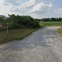
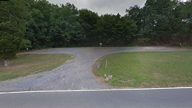
After approx. 0.4 mile to the State Game Lands parking area on your LEFT
Be careful pulling into the lot, it is usually rutted 


1692 Schoolhouse Road
Middletown, PA 17057
(parking lot is across the street from this address)

Link to download pdf map

Link to driving map


Detweiler Park

Detweiler Park

Detweiler Park has more than 7 miles of trails winding through varied habitats. Gardens, fields, meadows, evergreen plantations, and mature deciduous forests are some of the ecosystems in this biologically diverse park. Deer are seen frequently as well as a wide variety of birds including turkeys, hawks, woodpeckers, and bluebirds. Trails are open daily from dawn to dusk.

No hunting or trapping is allowed in this park so it is a good choice for hunting season.  The Airstip Loop and David’s Field Loop are flat so very good for winter walking or snowshoeing.


General Directions:
from 322 West
take Dauphin/Halifax rt 225 N exit
in 2 miles you will see 325 east/Clarks Valley Road to your right and 3Bs Ice Cream on your left
the entrance to Detweiler Park is just past this intersection and almost directly across the street from 3Bs
It is easy to miss the sign so slow down and keep you eye out for it.
1451 Peters Mountain Road
Dauphin, PA  17018

Link to their website


https://maps.app.goo.gl/G1Qg4Fe5cgfw7AMY6

You could picnic here in the summer months and 3Bs is another good choice for dinner.

AT Parking Lot on 325

AT Parking Lot on 325

There are several trail options available from this parking lot.  Heading South on the AT, you can climb back up Peter’s Mountain to the View.  You can walk the lower road in and out for an easy, flat walk in the woods.  You could take the AT North with a steep climb and do an out and back for any mileage.  The AT eventually connects with the Horseshoe Trail terminus.  Or you can do a 5.1 mile hike which is very strenuous with 1,200 feet elevation to the fire tower. It will take over 2 hours to finish.  This trail uses several connecting trails to form a loop.

The lot has plenty of parking, this area is heavily traveled when the thru-hikers come through in the Summer.

General Directions:

From Rt. 322 to Dauphin.  In Dauphin take Rt. 225 toward Halifax.  Before going up Peter’s Mountain turn RIGHT on Rt. 325.  Go 10 miles to the A.T.  parking lot  on the RIGHT.  Park in the bottom lot along the creek.

Appalachian National Scenic Trail
Halifax, PA 17032

Link to map

There is plenty of room to have a potluck in the parking lot afterwards or head back to the intersection of Routes 325 and 225 to eat at 3Bs during the summer months.

Trindle Road AT Parking Lot

Trindle Road AT Parking Lot

From this parking lot you can walk in either direction for up to 2 miles and get a nice 3-4 mile hike in on mostly flat terrain.  The lot is small and can only accomodate 8 vehicles.  This trail has not been part of our Wednesday night rotation due to another hiking group that goes there every Wednesday night.

General Directions:

From I-81 take the Mechanicsburg/Rt. 114 exit.  Take Rt. 114 to Mechanicsburg.  Cross the RR tracks and turn RIGHT on W. Main St. (this turns into Trindle Rd/Rt. 641) continue toward Carlisle.  Pass Old Stone House Rd. The A.T. lot will be on your RIGHT between Hickory Rd. & Boyer/Byers Rd. near the Appalachian Trail crossing.

1450 W Trindle Road

Carlisle, PA  17013


https://maps.app.goo.gl/kSd3io3gr333FErV6